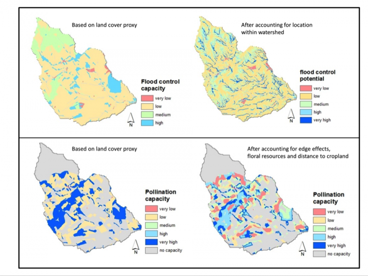
The mapping of ecosystem service provision is often a first step to assess the current state of the environment and to develop policies for ESs. By the year 2020, EU member states need to map the current state of their ecosystems and related services, as part of the EU biodiversity strategy. The mapping of ecosystem services heavily relies on land use and land cover data. Landscape structure, i.e. the spatial arrangement of land cover types and/or the presence of landscape elements like hedgerows and grass margins, is usually not taken into account when quantifying the amount of ecosystem service provision. This can be problematic, as for many ecosystem services the landscape structure affects the service supply. For example, pollination is usually high around forested sites. However, pollination also depends on the floral resources available in the area surrounding the forest and the distance between the forest site and agricultural land. Knowledge on the effect of landscape structure on the level of ES provision is crucial for effective land use planning.
OPERAs researchers Willem Verhagen, Astrid van Teeffelen and Peter Verburg (Vrije Universiteit Amsterdam) together with colleagues from the James Hutton Institute in Scotland took a first step in understanding the importance of landscape structure for ES provision. First, they identified via a review of the current literature which services landscape structure is important to. Next, they quantified six services with and without accounting for landscape structure and mapped the effects for Scotland. They show that within a landscape the landscape structure can indeed alter the level of ES provision. For example, flood control capacity is especially increased for natural vegetation close to streams and rivers. The study contributes to a better understanding of how landscapes provide ecosystem services, and can assist the land use planning process.
Willem Verhagen & Astrid van Teeffelen
